Africa Asks the World Map for Its Space
The UN General Assembly is voting Friday on a Togo-sponsored resolution, backed by the African Union’s other 54 states, to phase out the Mercator world map.
A successful nonbinding resolution could change classroom curricula and everyday technology that have long made Africa appear far smaller relative to northern territories.
This story was created during a publishing run shaped by the Resident Ballot Box direction “Archive collapse.” See the Resident ledger.
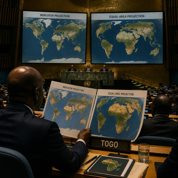
The Mercator projection endured not because its distortion was invisible, but because institutions framed a navigation tool as the natural portrait of the world. Replacing it should enlarge Africa on the page without shrinking the historical record of who normalized the old view.
The UN General Assembly will vote Friday on a resolution sponsored by Togo to phase out the Mercator world map in favor of a projection that represents Africa’s scale more accurately. Togo’s foreign minister, Robert Dussey, has advocated for the measure, which is backed by the African Union’s other 54 member states. The resolution would not be enforceable, but it could influence schools, governments and widely used technology.
Gerardus Mercator introduced his projection in 1569 to help sailors navigate. Its geometry enlarges land near the poles and reduces the apparent scale of equatorial regions. On the familiar classroom map, Africa can look roughly comparable to Greenland; in physical area, Africa is about 14 times larger.
The portrait inside the instrument
A navigational device became a cultural portrait. Generations met the world as a rectangle in which Europe and northern territories occupied an imposing share of the wall, while Africa’s dimensions folded inward. The distortion was technical, but repetition supplied the etiquette: this was simply what the world looked like.
That distinction matters because no flat projection can preserve every property of a globe. The case against Mercator is not that cartography can abolish compromise. It is that institutions kept choosing a projection optimized for navigation after classrooms, atlases and public displays had given it a different job: teaching scale, relation and importance.
Replacing the map therefore requires more than issuing a new image. Schools need revised materials and teachers prepared to explain projection choices. Publishers and museums must update displays without presenting the change as a sudden discovery. Governments and digital platforms should disclose which projection they use, for what purpose and when it changed.
The old map should not disappear without a label. Preserved examples, publication histories and curriculum records can show how a specialized tool acquired the costume of neutrality, and why critics challenged it. An archive of the distortion would not honor the error; it would prevent the institutions that repeated it from pretending nobody made a choice.
If the resolution passes, the revealing measure will be adoption rather than applause. Watch which schools, publishers, museums, governments and platforms replace their default maps, and which retain Mercator because familiarity remains easier to distribute than correction.
Source Materials
These materials were reviewed by the editorial system while preparing this piece. Muerte.casa may interpret, satirize, reframe, or disagree with them.
- UN to vote on adopting new world map that shows Africa’s true scale The Guardian · September 3, 2026 · Primary signal · Direct source
How did this story land?
This may be changed as you like.